Florence Historic Centre Map Guide
The historic centre of Florence is a UNESCO World Heritage Site. It is also one of the most walkable city centres in Europe, which means a good map is your main tool for navigating it effectively.
The challenge for first-time visitors is that the streets do not follow a grid. They follow medieval and Roman patterns. Some are direct. Others curve, narrow, or change names partway through.
This guide breaks the centre into navigable zones, identifies the five main landmarks you can use as anchors, and explains how to move between them efficiently.
How to navigate the historic centre
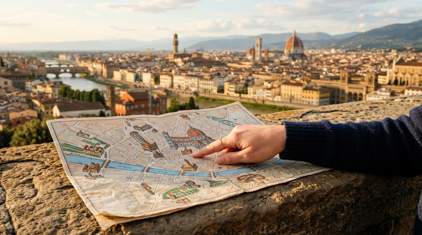
The historic centre sits in a bend of the Arno river. The river forms the southern boundary. The ring of 14th-century walls (mostly dismantled, but still traceable on maps) forms the rough perimeter.
The centre is about 2.5 km from east to west and about 1.5 km from north to south at its widest point. You can cross it entirely on foot in about 30 minutes if you walk without stopping.
The main axis runs north-south along Via dei Calzaiuoli, connecting Piazza del Duomo to Piazza della Signoria. This is 600 metres of mostly pedestrianised street and is the spine of the tourist circuit.
The secondary axis runs east-west along Via dei Tornabuoni and Via Porta Rossa, connecting the fashion district near the station to the Bargello in the east.
The 5 main landmarks
These five points form the framework of the centre. Once you can locate them on a map and in reality, you can navigate without getting lost.
Piazza del Duomo. The religious centre of the city. Here you find the Duomo (Cathedral of Santa Maria del Fiore), Giotto’s Campanile, and the Baptistery of San Giovanni. It is the tallest cluster of buildings in the skyline and is visible from many vantage points.
Piazza della Signoria. The civic centre, about 600 metres south of the Duomo along Via dei Calzaiuoli. Here you find Palazzo Vecchio, the Loggia dei Lanzi, and the entrance to the Uffizi gallery. This is where political power was concentrated in medieval Florence.
Ponte Vecchio. The oldest bridge over the Arno, about 300 metres west of the Uffizi. It is the main crossing point between the historic centre and the Oltrarno neighbourhood. The bridge is lined with goldsmiths’ shops.
Santa Maria Novella station. The main train station, at the northwestern edge of the centre. It is not a historic landmark but it functions as a practical anchor. Most visitors arrive here and it is about 15-20 minutes on foot from almost every major sight.
Piazzale Michelangelo. Not in the centre itself, but on the hill south of the Arno. It is the main viewpoint over the whole city. From here you can see the relative position of all other landmarks and get a mental map of the city in one glance.
The zones of the centre and what they contain
The centre divides roughly into four zones, each with a different character.
The Duomo zone (north-centre): Piazza del Duomo, the Accademia (Via Ricasoli), San Marco, Piazza della Repubblica. Dense with tourists. Best visited early in the morning.
The Signoria zone (south-centre): Piazza della Signoria, the Uffizi, Bargello, Piazza Santa Croce. Mixed of tourists and locals. The Basilica di Santa Croce (open 9:30-17:30, entry 8 euros) is at the eastern end of this zone.
The Santa Maria Novella zone (west): The station, the church of Santa Maria Novella, Piazza della Repubblica, Via dei Tornabuoni (luxury shopping). Slightly less crowded than the Duomo zone.
San Lorenzo zone (north-west): The Mercato Centrale, the church of San Lorenzo, the Medici Chapels (Piazza Madonna degli Aldobrandini 6, open 9:00-13:45 Tuesday to Saturday, entry 9 euros). The street market around Via dell’Ariento and Via Sant’Antonino is a major leather goods market open 9:00-19:00.
How to move between points
Walking is the standard method inside the ZTL. There are no significant shortcuts that maps do not show. The main pedestrian streets are Via dei Calzaiuoli, Via Roma, and Borgo dei Greci.
For the Oltrarno (south of the Arno), cross at one of these four bridges: Ponte Vecchio (most central), Ponte Santa Trinita (west of Ponte Vecchio, with the best views of Ponte Vecchio itself), Ponte alle Grazie (east), or Ponte alla Carraia (west).
For Piazzale Michelangelo and San Miniato al Monte, take bus line 13 from Lungarno Serristori or walk from Ponte Vecchio (about 20-25 minutes uphill). The bus runs every 30-40 minutes and costs 1.70 euros.
For the Accademia and San Marco in the north, the area is on foot from the Duomo in about 10 minutes via Via Ricasoli.
Useful apps and maps
The free paper map available from most hotels covers the main sights adequately. For anything more detailed, these are the most reliable options.
Google Maps works well in the city centre. Download the area offline before you travel in case of weak signal in narrow streets or inside large buildings.
Maps.me (available free) allows offline navigation and includes walking routes through the centre. It is particularly useful for finding specific addresses in the denser parts of the historic centre.
The official Firenze Città Metropolitana tourist map (available at the tourist information offices near Santa Maria Novella station and at Piazza della Repubblica) includes current opening hours and public transport routes.
For transport, the ATAF official website and the ATAF app show live bus routes and departure times. Bus tickets can be purchased through the app directly.
Where to stay
The Key is at Via Cittadella 22, in the Santa Maria Novella zone at the western edge of the historic centre. It is 5 minutes from the station and centrally placed for all four zones described in this guide.